Each Group should pick a borough, examine and analyse the pollution maps. Feel free to do your own research on the borough to discover the nature of the borough.
The groups could think about some of these question.
- What are the main pollution hotspots?
- What urban features appear to explain these hotspots?
- What hypothesis best explains the observed pattern?
- What additional data would you need to test your hypothesis?
- What intervention would you recommend to improve air quality?
- How does urban design influence the air that Londoners breathe?”
City of Westminster
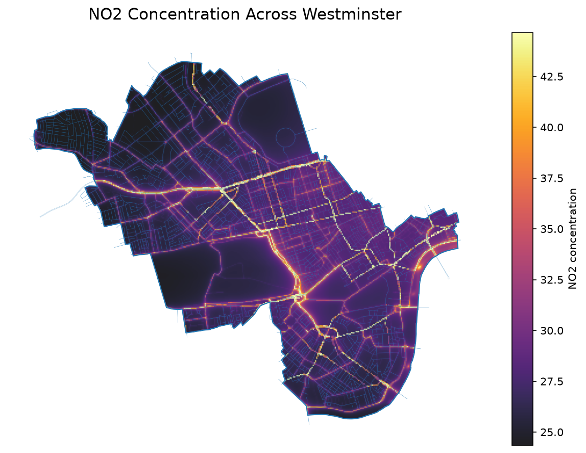
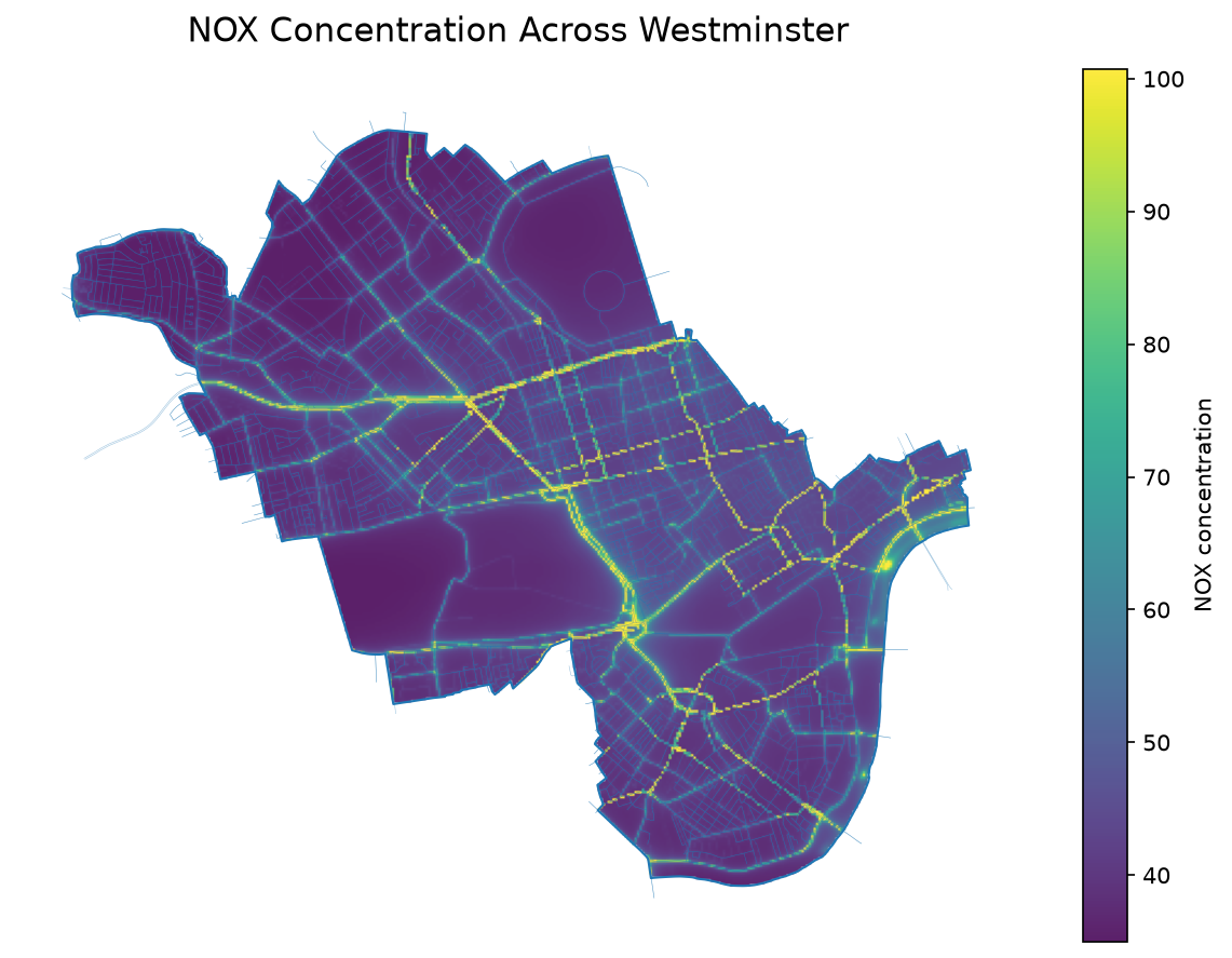
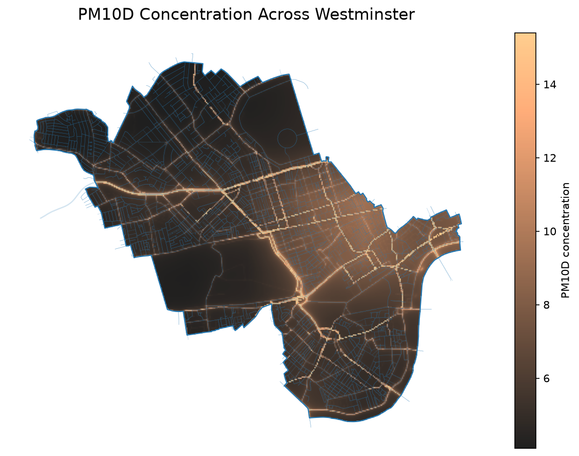
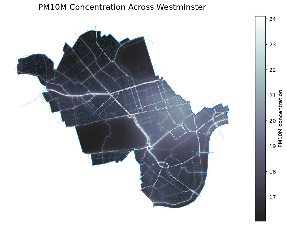
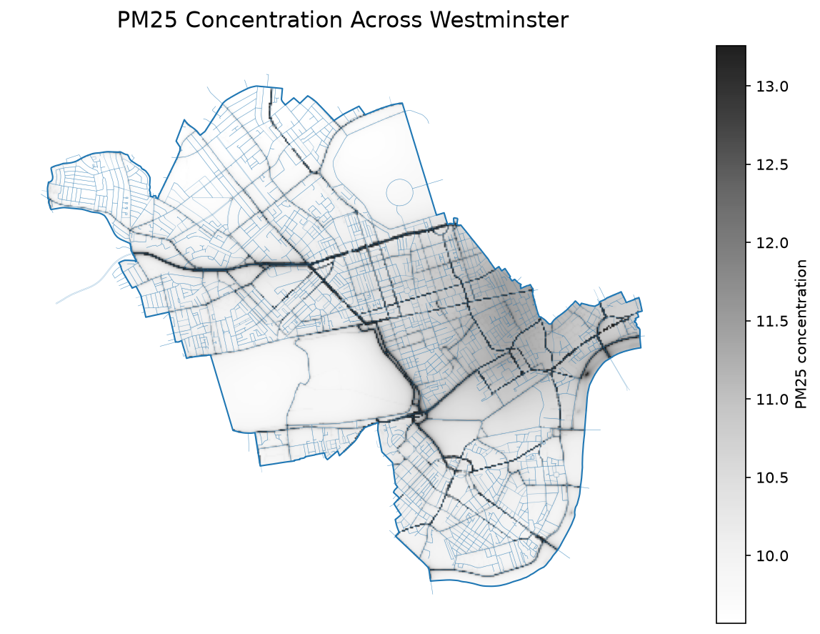
Character
- Dense city centre, buses, street canyons
Relevant concepts
- Urban morphology and transport infrastructure
How does the street network influence the spatial distribution of air pollution?
- Are pollution hotspots primarily determined by traffic volume, or do street canyons and the built environment also play an important role?
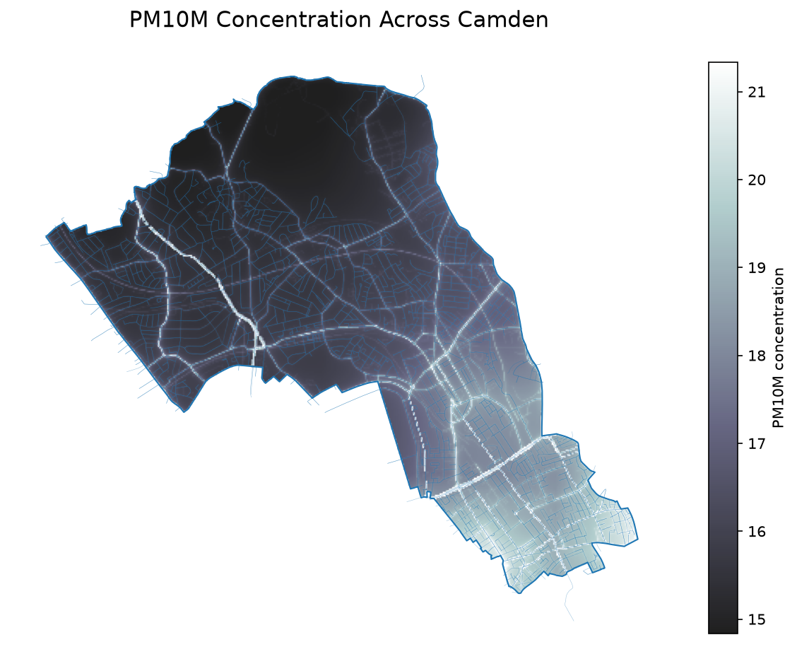
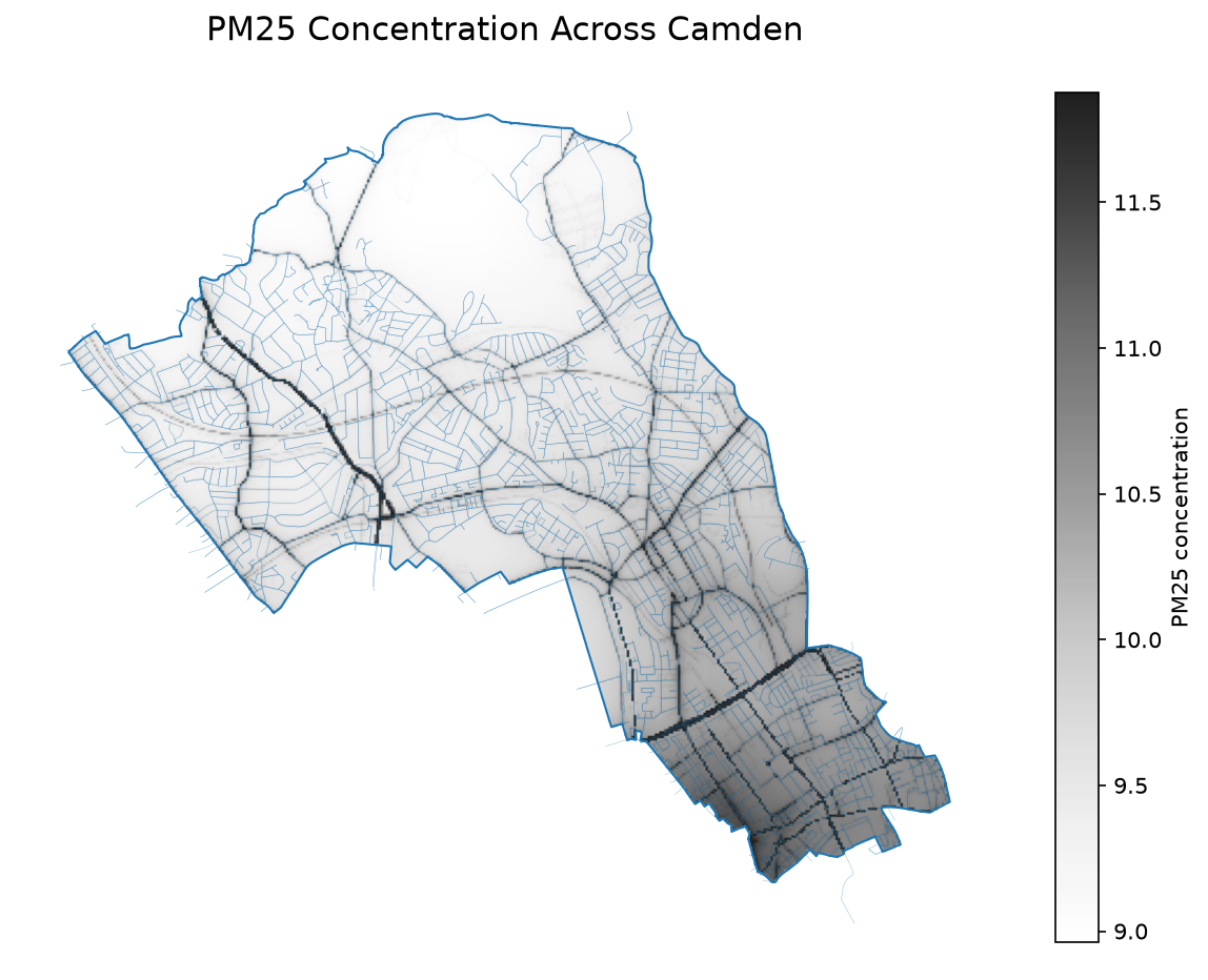
Camden
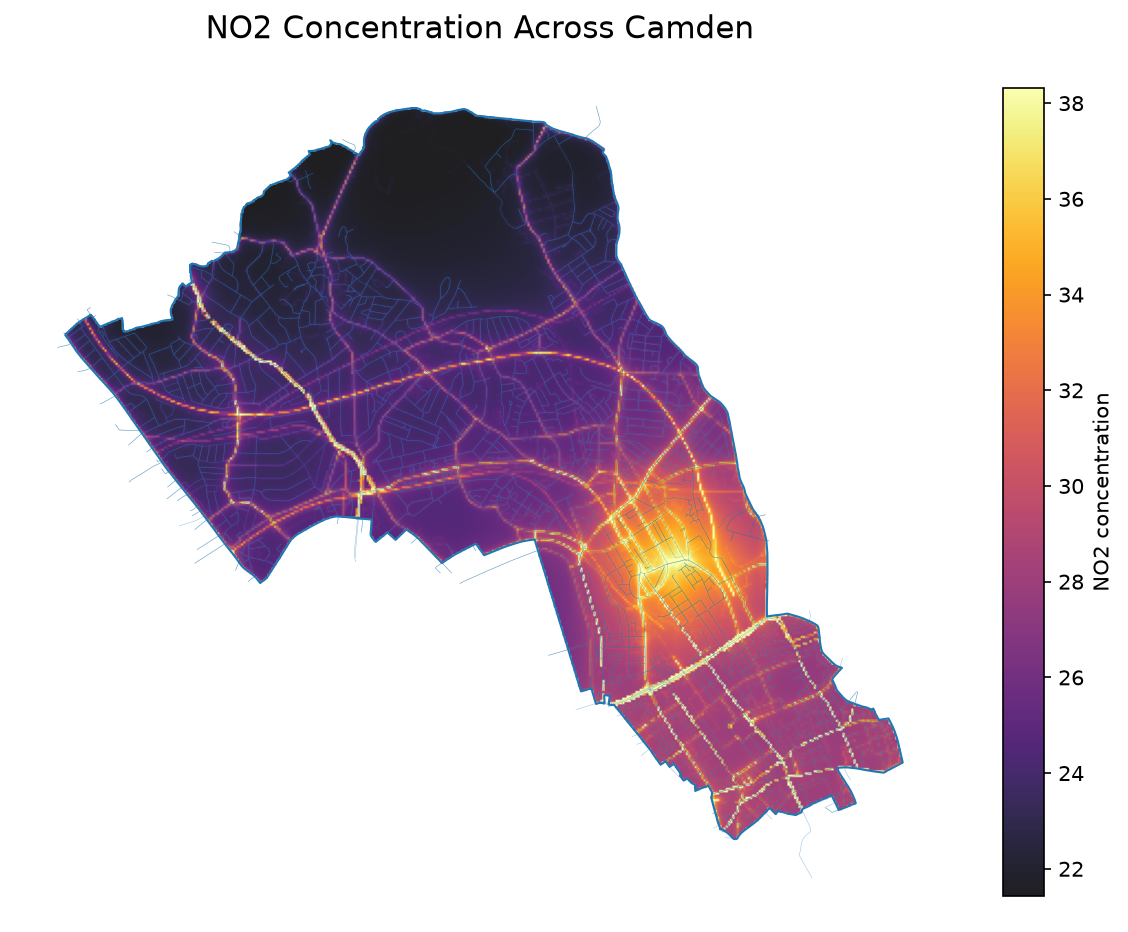
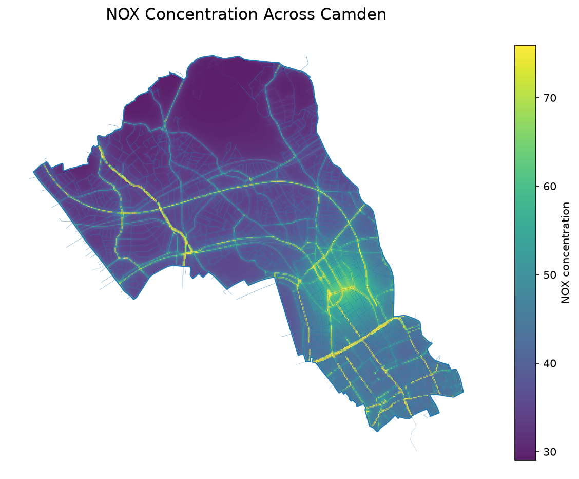
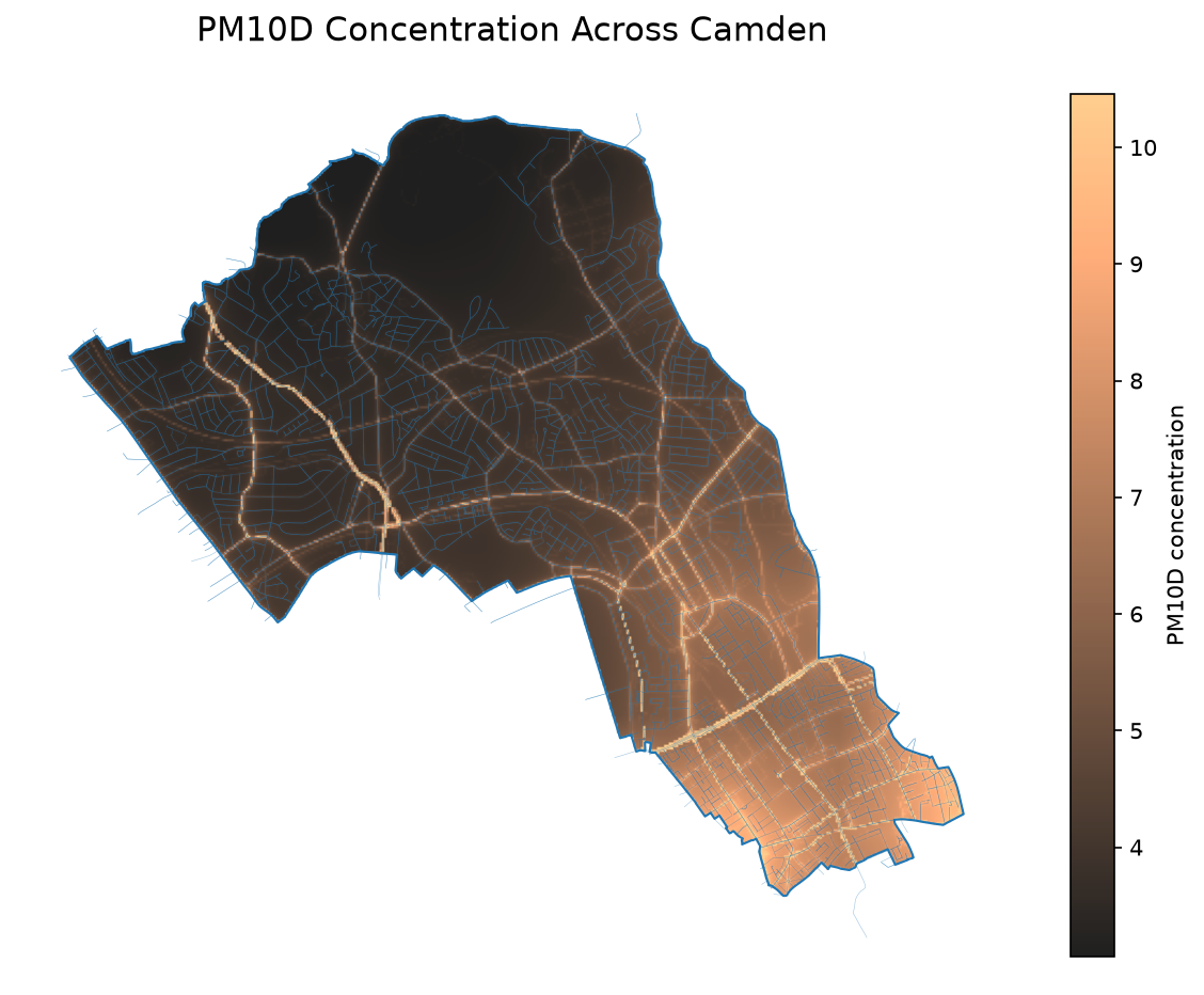
Character
- Major roads, parks and canals
Relevant concepts
- Green and blue infrastructure
Do parks and waterways create measurable improvements in local air quality?
- Compare pollution levels around Regent’s Park and Regent’s Canal with nearby major roads such as Euston Road.
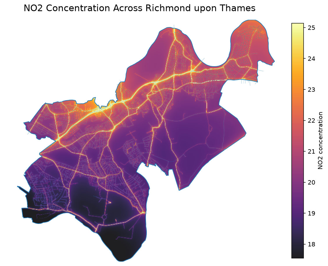
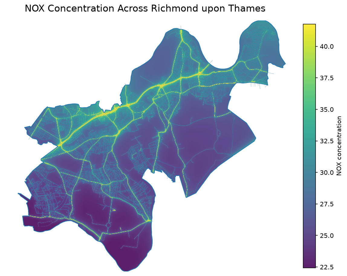
Richmond upon Thames
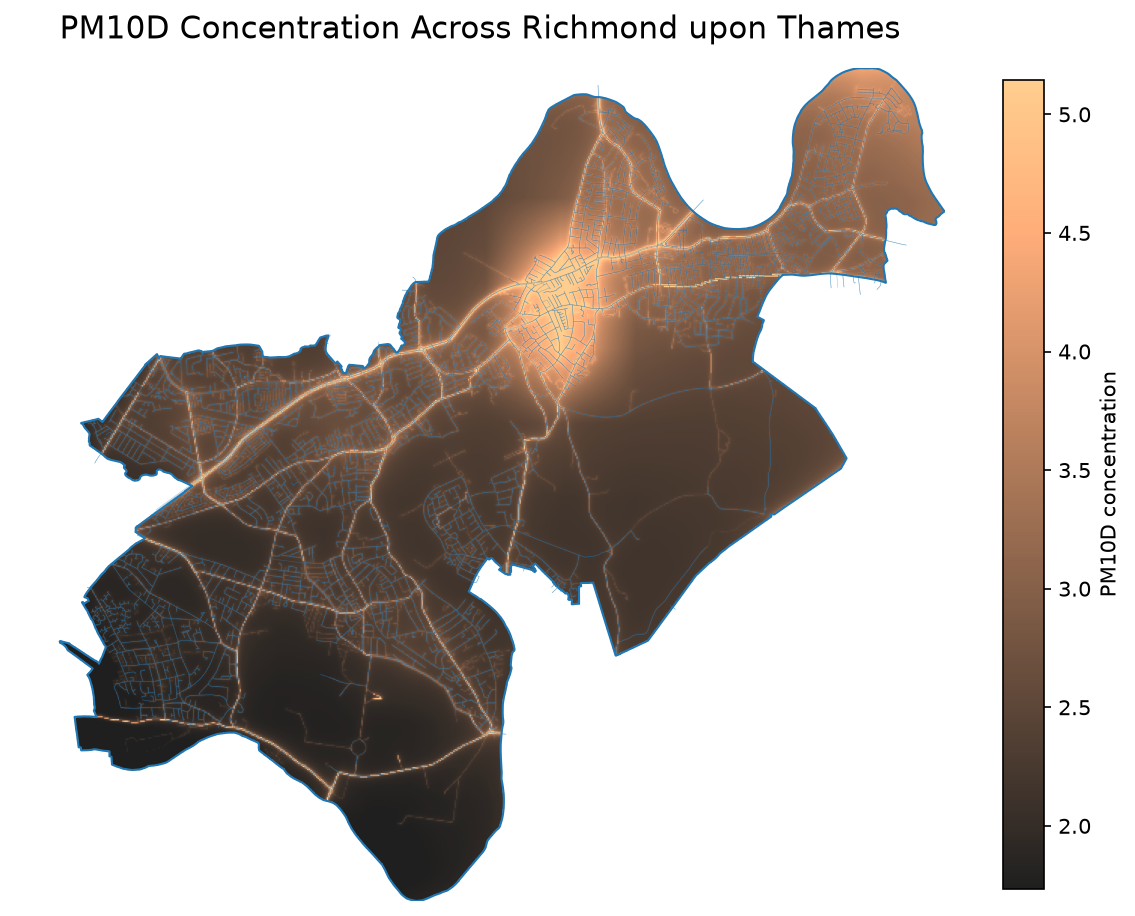
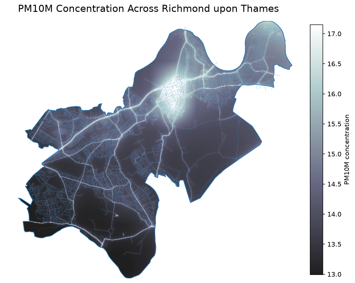
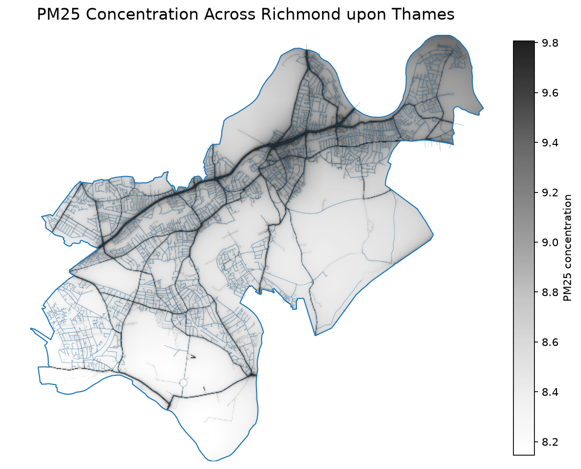
Character
- Green space and the River Thames
Relevant concepts
- Ecosystem services and urban resilience
Can extensive green infrastructure offset the effects of urbanisation?
- Identify where pollution remains elevated despite the borough’s large parks and river frontage.
Newham
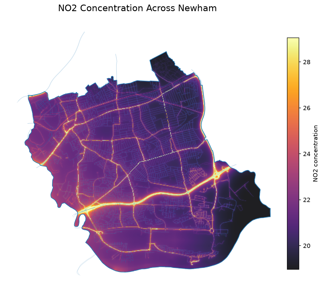
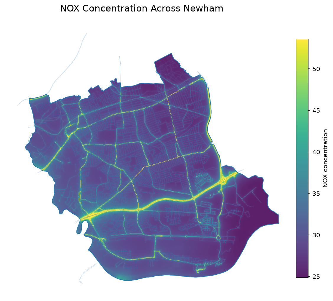
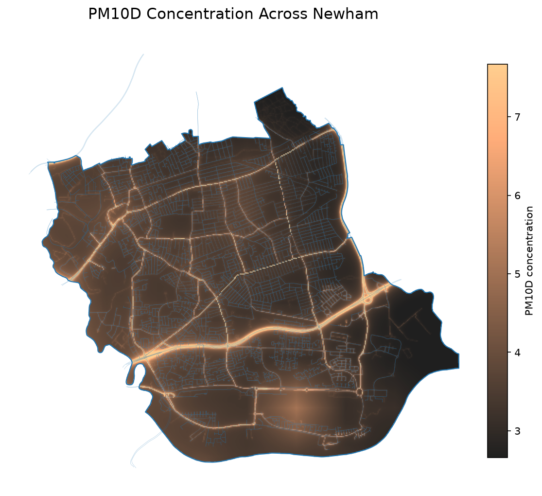
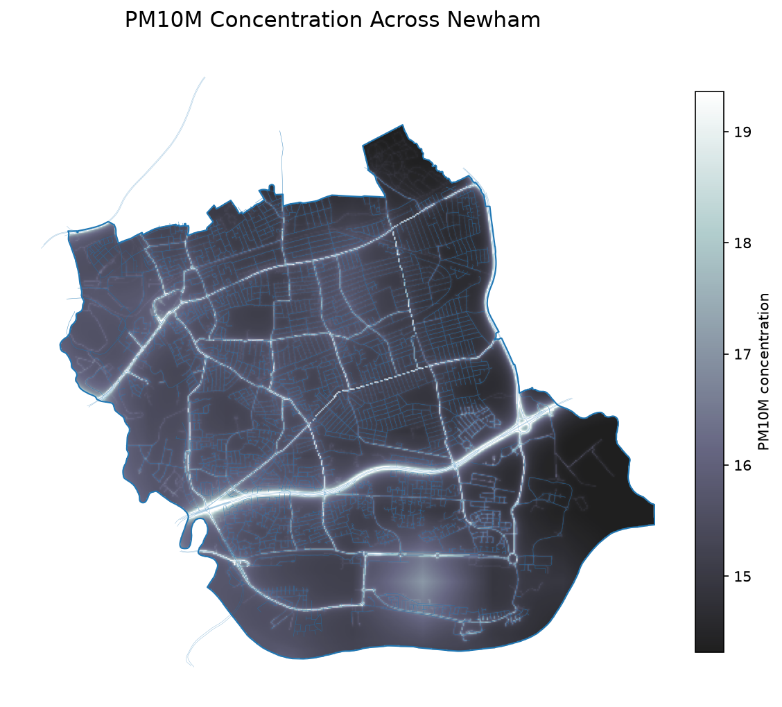
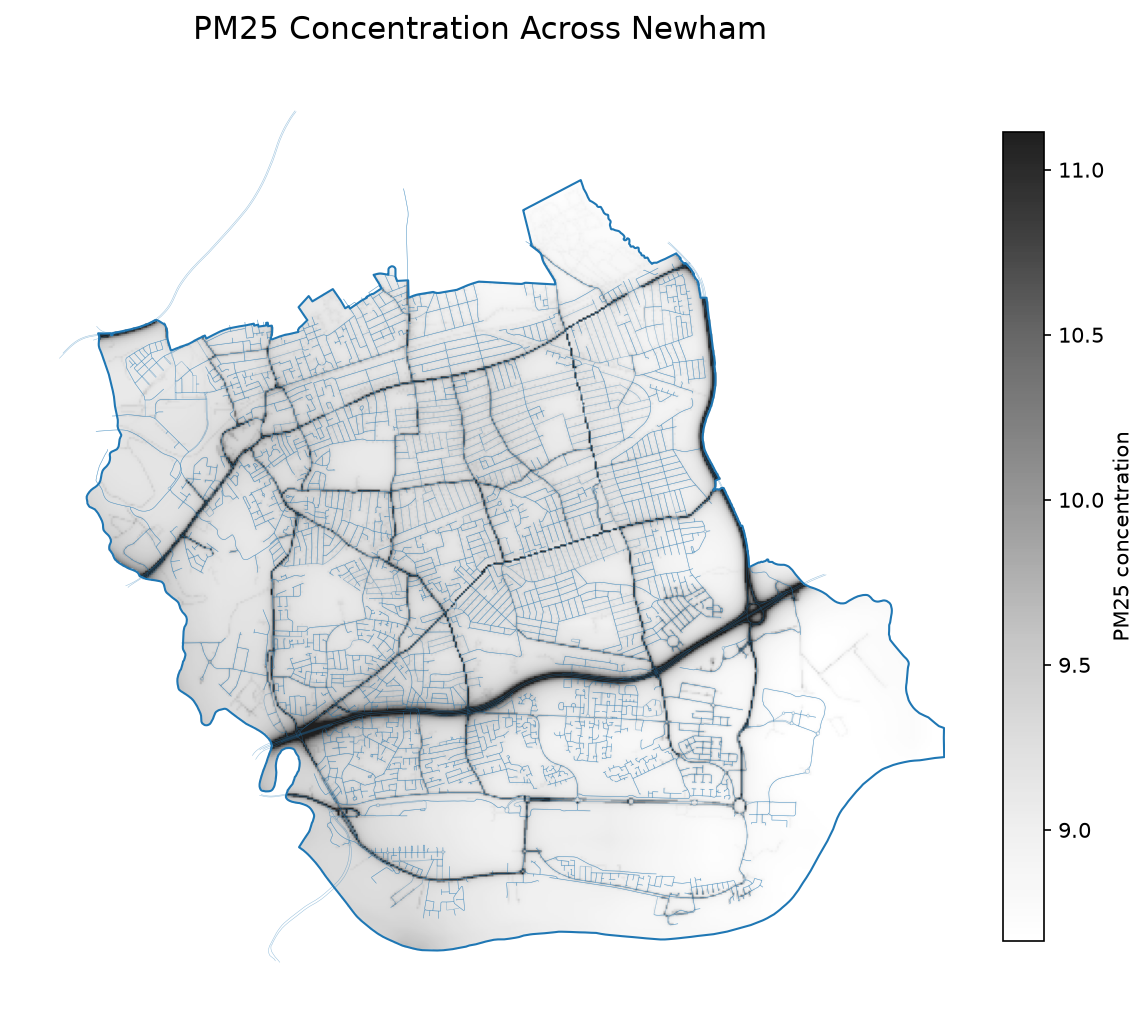
Character
- Regeneration, industry and airport influences
Relevant concepts
- Urban regeneration and multiple emission sources
How do regeneration, transport infrastructure and London City Airport interact to shape air quality?
- Can you distinguish the influence of roads, industry and aviation from the spatial patterns?
Tower Hamlets
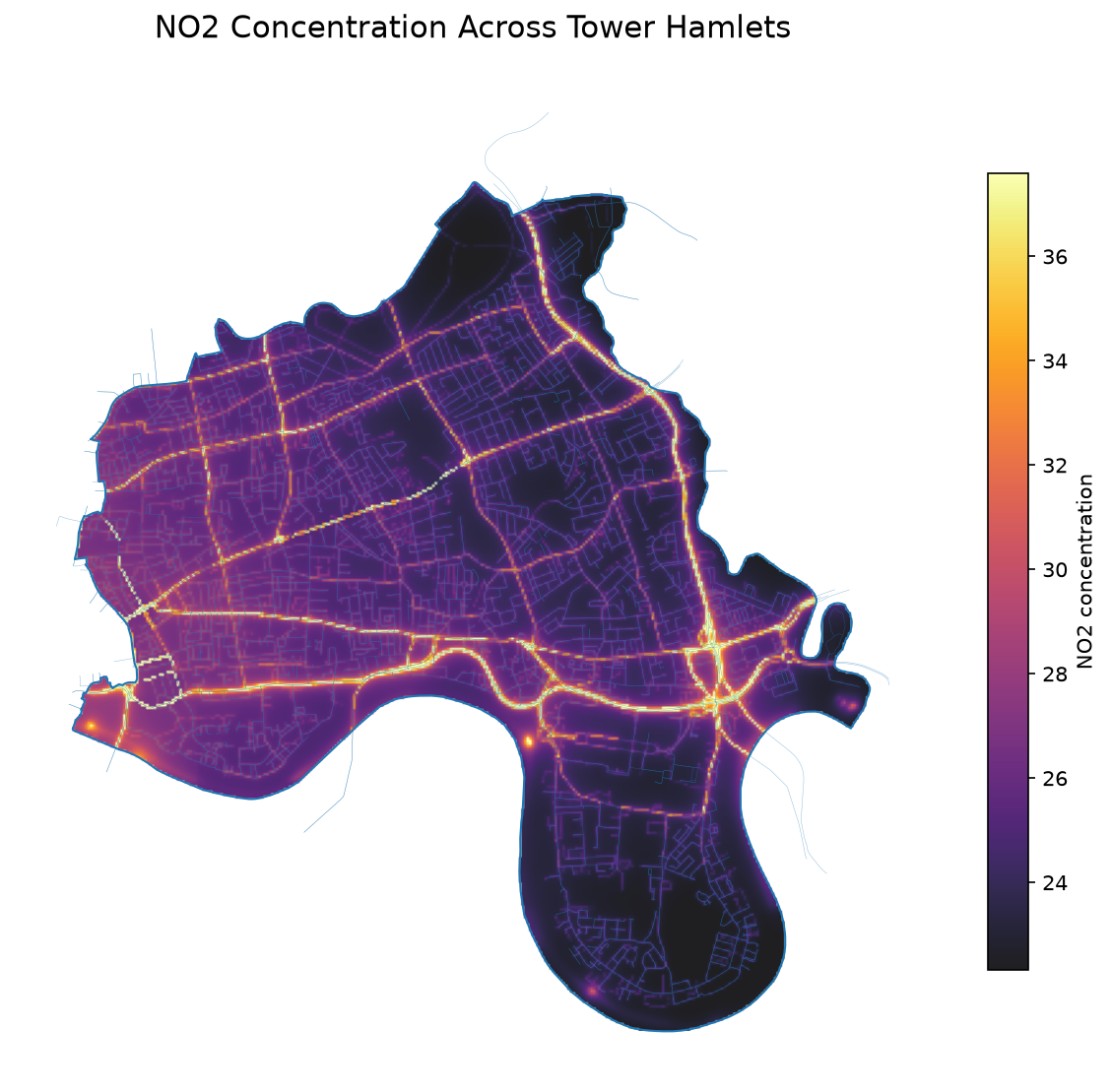
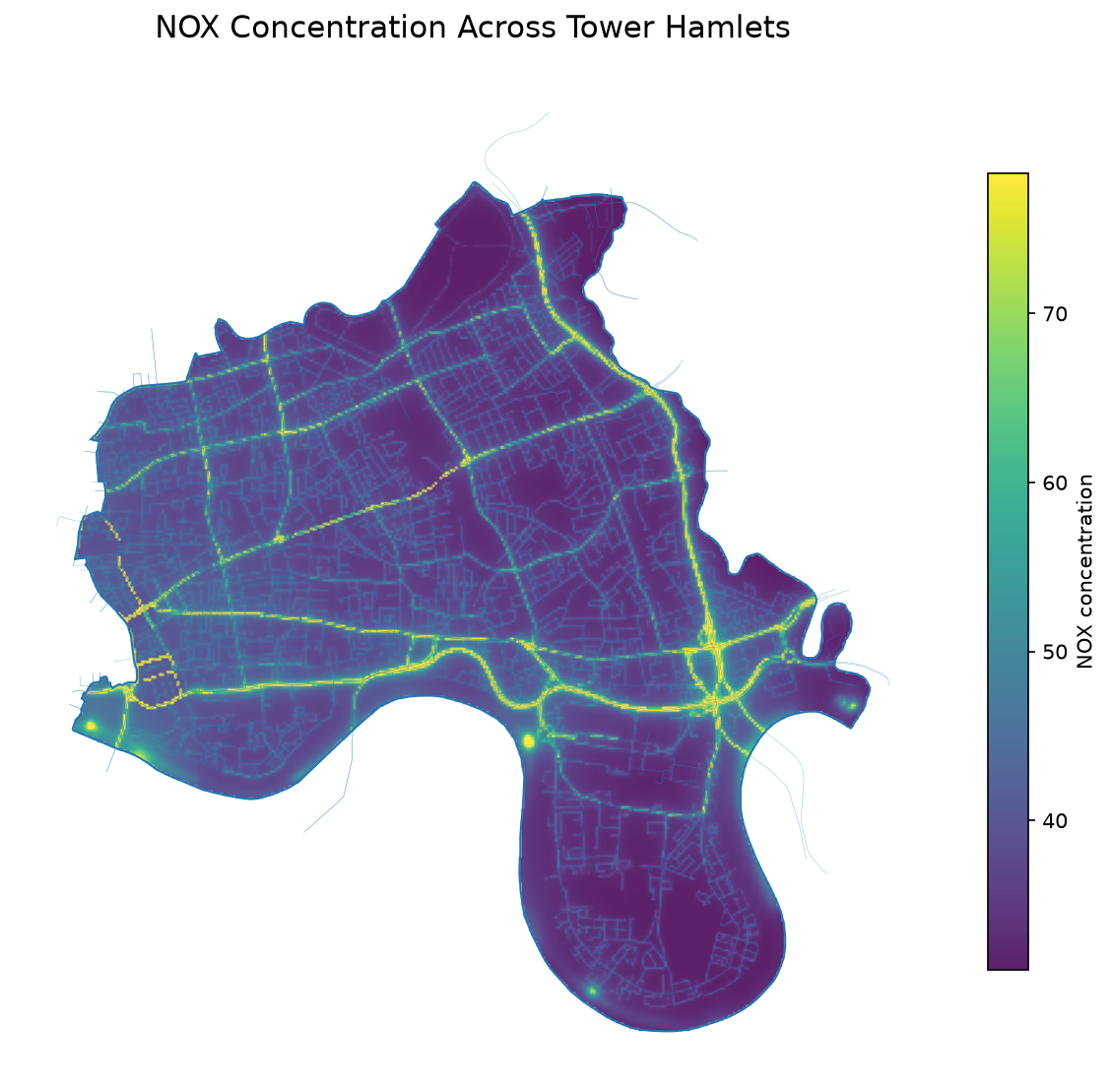
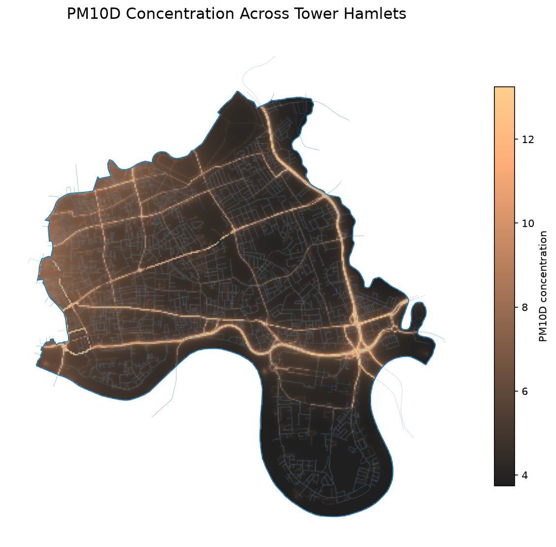
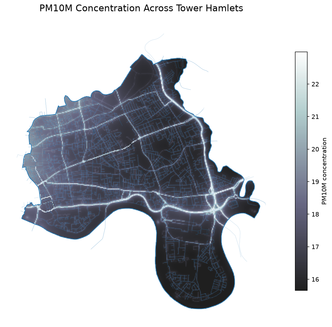
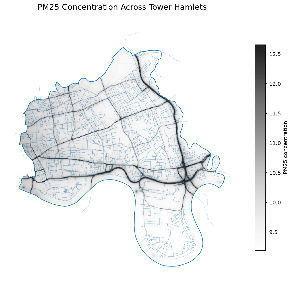
Character
- High-density development and Docklands
Relevant concepts
- Density, land use and ventilation
Does high-density development increase or decrease local pollution?
- Compare pollution around Canary Wharf, residential areas, the Thames and major transport corridors.
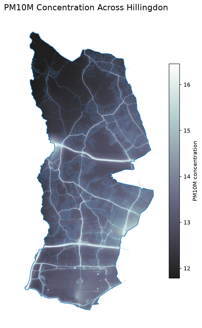
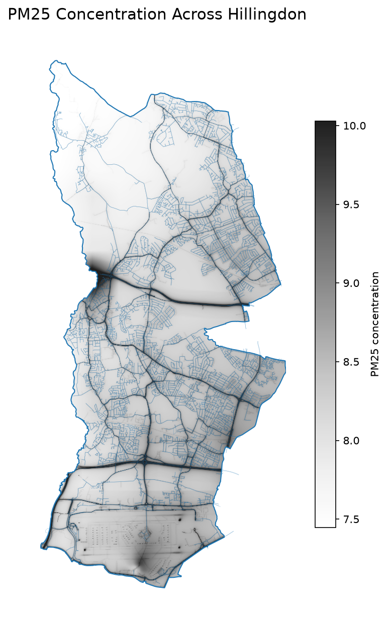
Hillingdon
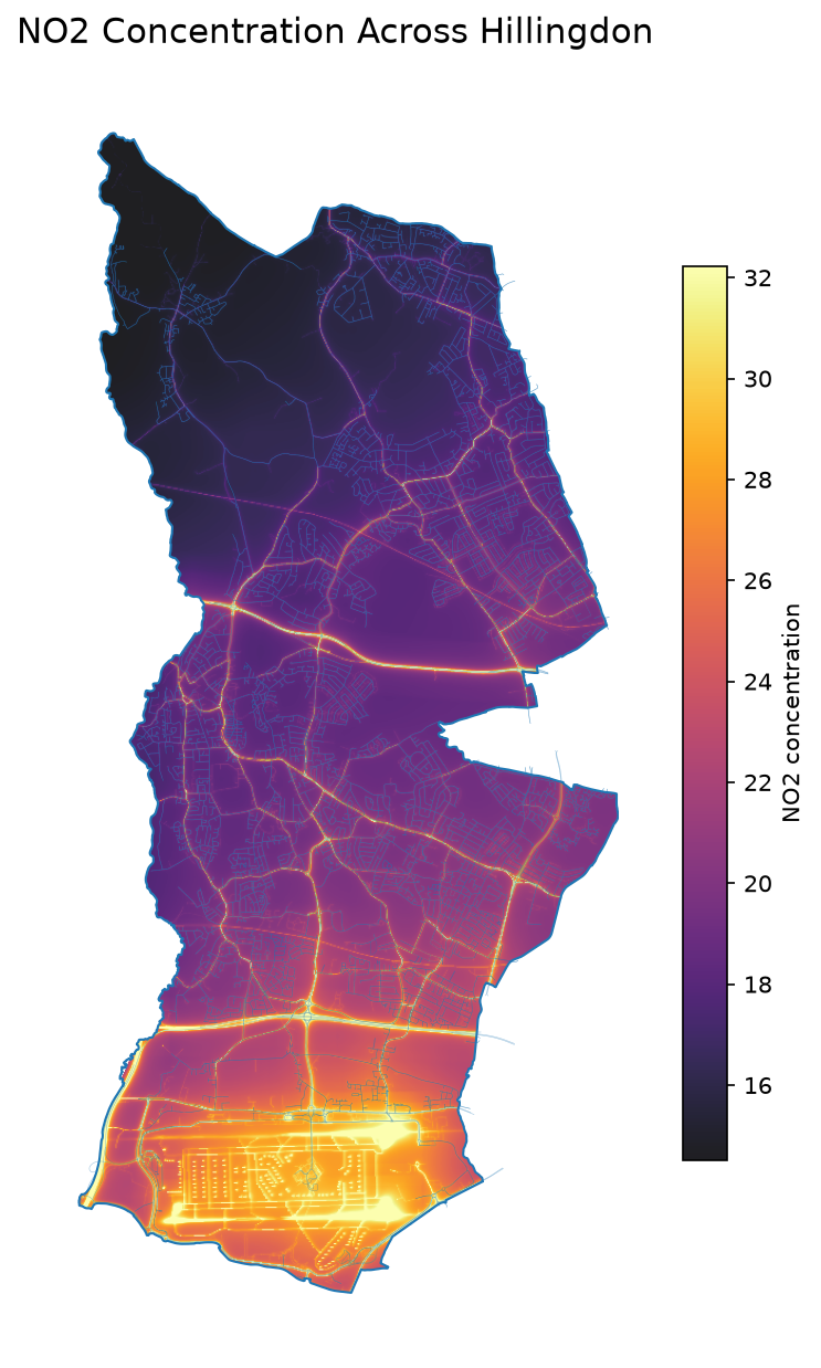
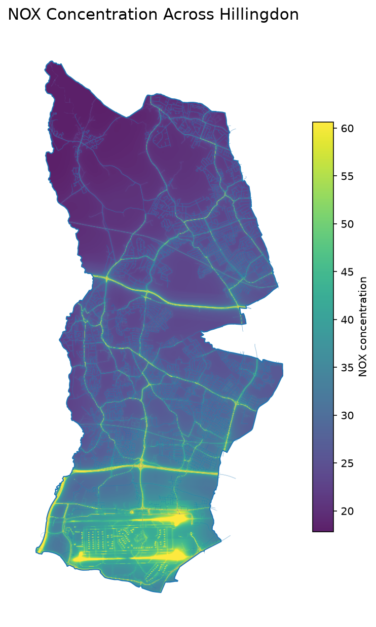
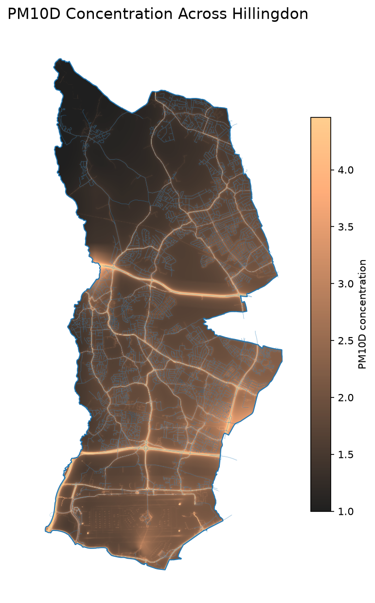
Character
- Heathrow Airport and motorway network
Relevant concepts
- Aviation and regional transport
How far does the influence of Heathrow Airport extend?
- Can you identify spatial patterns that appear consistent with airport operations rather than road traffic alone?